DIY Guide to Biri Island Rock Formations (Northern Samar)
The Biri Island Rock Formations is one of the best places you can visit in Northern Samar. We went here during a week-long road trip to Leyte. Here’s our experience + travel guide to Biri Island Rock Formations in Samar!
Biri Island is a municipality in northern Samar. The island itself is located along the path of storms, which resulted in rugged landscapes.
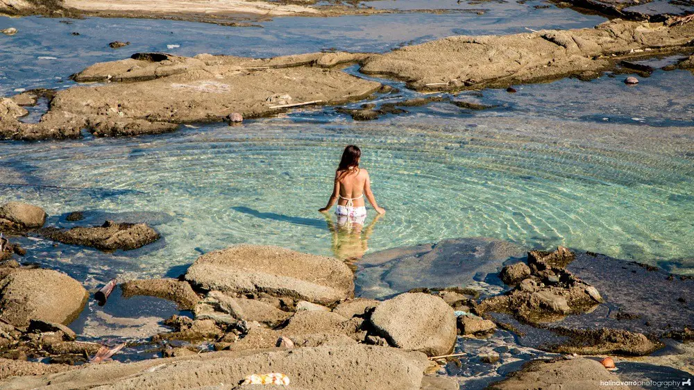
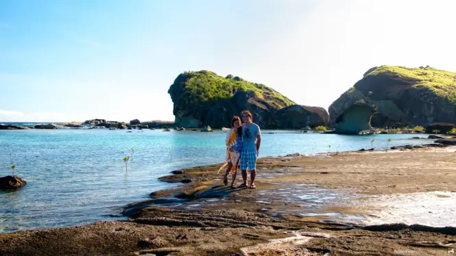
There are seven rock formations in Biri Island (Magasang, Magsapad, Macadlaw, Puhunan, Bel-at, Caranas and Pinanahawan). These were formed some 20 million years ago from the movement of tectonic plates and then molded by crashing waves, winds and storms. The rock formations have distinct looks. For instance, Bel-at and Caranas feature smooth limestone formations and natural saltwater pools, while Magasang features pockmarked formations.
All the rock formations are accessible by foot during low tide.
Contents
Our trip to Biri Island
From our resort in Bani Island, we took a boat to Biri Island. Once we arrived, we went straight to the tourism office for registration. We were assigned habal-habal tour guides that drove us to the jump-off point to the rock formations.
Since we were there for a day trip, we only scheduled to see Bel-at & Caranas and Magasang rock formations, which are the most visited spots. Our tour guide Kuya Louie said that we would need 2 days if we wanted to explore all the rock formations, as well as do other activities including surfing.
From the jump-off point, we walked across a boardwalk trail surrounded by mangroves and other shrubs to Bel-at & Caranas.
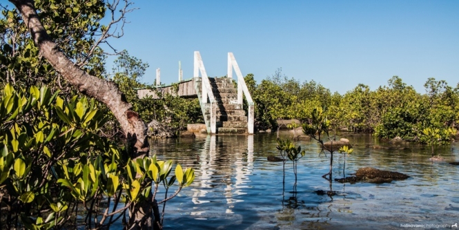
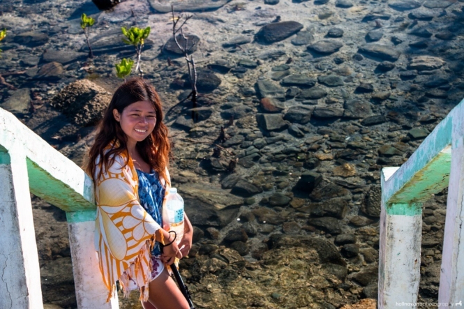
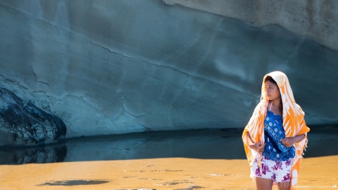
Bel-at & Caranas rock formations is one of the most recognizable spots in Biri Island due to the picturesque saltwater pools formed between limestone formations. Bel-at & Caranas are connected, so most tourists simply refer to the area as Bel-at.
Once we got here, we immediately noticed people swimming on a huge tidal pool. I initially thought that it was the beach area since it was high tide. We took pictures here and then climbed up some low boulders to take pictures of the ocean.
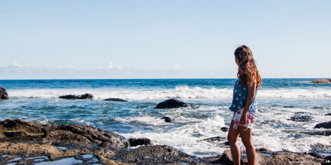
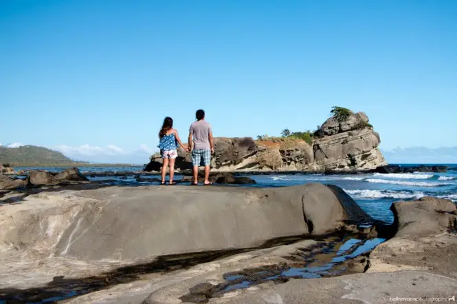
“We fall in and out of love in every one of these stories. I feed you dandelions. I eat honey off your back. We hold hands like we are going to fall off the edge of the universe together.” – Azra T
We then explored the limestone formations which are reminiscent of Kapurpurawan Rock Formation in Ilocos Norte. Hali thinks they look like a dessert background in Star Wars, which I can definitely see.
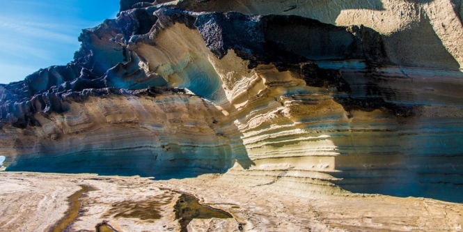
With the rest of the tour group, we climbed a cliff that offers a nice overlooking view. I asked Hali to stay in the cliff and take pictures of me while I went down to one of the pools below, and it was some of my favorite photos during my travels.
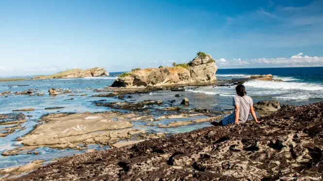
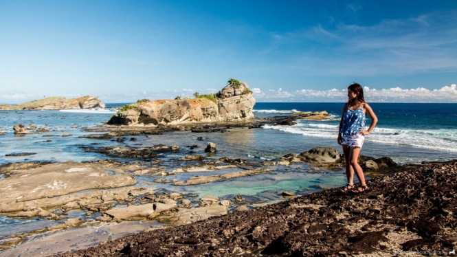
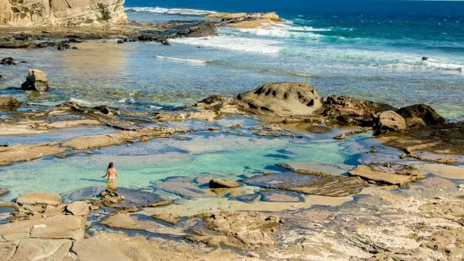
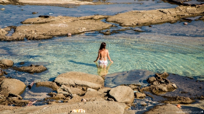
From Bel-at & Caranas rock formations, we rode the habal-habal to Magasang rock formation. We wade through shallow seawater to get to the actual rock formation. There is a bridge in the middle that helps tourists cross and also serves as rest stops for families with picnic items.
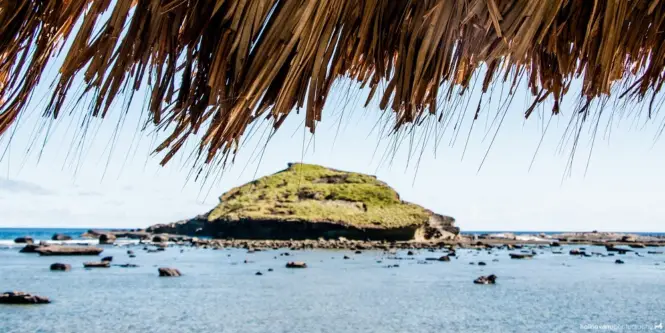
Similar to Bel-at, the floor in Magasang was slippery. Moss covers some of the surface. One of our companions slipped, so our tour guide instructed us to walk across dry ground only.
The floor in Magasang rock formation is slippery, similar to Bel-at’s. Moss covers some area. One of our companions slipped on the floor, and our tour guide then told us to walk across dry ground only.
The cliff in Magasang offers natural stairs so it’s possible to climb up all the way to the top. The surface here looked like spider webs, with natural footholds for climbing. It was tiring but the ocean view from above was rewarding.
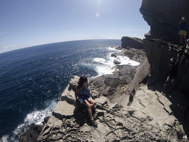
Again, there’s a full horizon of boulders where the sea waves crash. It was fascinating to watch and somewhat relaxing.
Overall, we enjoyed our tour in Biri Island. I didn’t have much expectations on what to see here and so the views caught me by surprise. Biri Island is indescribably beautiful. It’s a definite must-see when you’re in Samar Province.
How to get to Biri Island
By air
From Manila, you can take a flight to either Catarman in Northern Samar or Calbayog in Eastern Samar.
Via Catarman
- Take a local flight to Catarman.
- From the airport, ride a tricycle to the main transport terminal (5 min, P100). From there, ride a jeepney bound for Allen or Calbayog and get off at Lavezares town proper (1 hour, P50). Walk towards Lavezares Port.
- From the port, ride a pumpboat to Biri Island (45 min, standard fare P50 + terminal fee P25).
Upon arrival at the port in Biri, you will find habal-habals waiting to take you to the tourism office or your selected accommodation.
Via Calbayog
- Take a local flight to Calbayog.
- Ride a jeepney or van bound for Allen. Then transfer to a trike to Lavezares.
- Same instruction as above.
By land
- From Manila, ride on a bus to Matnog, Sorgoson. From Matnog port, ride a ferry to Allen. Then ride a jeepney to Lavezares.
- Same instruction as above.
When is the best time to visit
The best time to visit Biri Island is during the dry months (February to May). The best time to see the rock formations is during low tide.
Where to stay
There are homestays and resorts where you can stay at in Biri Island. Here are some you can book online:
Click here to see discounted rates of accommodations in Biri Island.
Things to do in Biri Island
Biri Island is known for its rock formations. If you’re staying here for longer, here are other available activities:
1. See the Biri Rock Formations
This is the most popular activity in Biri Island. There are a total of seven rock formations you can visit ((Magasang, Magsapad, Macadlaw, Puhunan, Bel-at, Caranas and Pinanahawan). You need to allot 2 days if you want to explore all of these.
2. Enjoy a 360 degree view at Busay
Busay is one of the highest points in Biri Island. It has a natural viewdeck that offers a sweeping view of the landscape and surrounding islands.
https://www.instagram.com/p/BzVapg4hr6l/3. Surfing
Biri Island is one of the surfing destinations in the Philippines. The best months for surfing are June to December.
4. Diving
While it is best known for its rock formations, Biri Island is also a great place for diving. It has over 20 dive sites where you can see colorful reefs and wildlife such as sharks. The best time to visit for diving is during the summer.
Biri Resort and Dive Center is currently the only dive operator in the island.
5. Beach Camping
If you’re planning to relax, book a room in one of the laid-back resorts in Biri Island or hop on a passenger boat to other nearby beaches such as Bani Island.
Others
- See the old lighthouse in San Bernardino Island.
Budget and expenses
Once you register at the tourism office, you will need to pay for the following (Updated as of 2020):
- Tourism fee – P50 per person
- Guide fee – P300 good for 5 pax
Guides are required when visiting the rock formation. This allows the LGU to oversee the tourist activity in the area and it also helps the locals’ livelihood.
Reminders and Tips
Here are some reminders and tips before you go!
- Bring enough cash with you. Biri Island is relatively remote, so credit cards are usually not accepted. If you need to withdraw cash, you can head to Allen.
- Bring appropriate footwear and sunblock when touring the rock formations.
- Eateries can be found near the tourism office. There is also a station at Bel-at rock formation where you can eat or cook. Eating at the rock formation sites is discouraged to avoid leaving trash in the area.
- If you’re interested in similar destinations, you can visit Kapurpurawan in Ilocos Region.
Have you been to Biri Island, Samar? What was your experience? Let us know in the comments below!
What to read next:
This is part of our long road trip from Manila to Leyte. Here are other places we’d written about:
If you like this pin, feel free to share it in Pinterest!

Katherine Cortes is a long-time backpacker and a freelance writer/editor. She likes beaches, snorkeling trips, and relaxing staycations (preferably with bath tubs!).


6 Comments
Darlene
Bookmarking this! I’ve always wanted to go to Biri! Should have went there when I was assigned in Catarman a few years back. Hopefully i’ll get to visit soon. Thanks for sharing!
safetravelsbysally
I have never heard of Bani Island, Samar. It looks a little bit like Australia the rock formations along the water. Sydney has a similar area. I would love to go to the Philippines soon!
yogoandcream
The Biri rock formations look breath taking. Really majestic! Your posts never fail to inspire me to go out and travel. How I wish I can quit my job and just travel to the places you’ve went to. Hahaha! Anyway, I’m happy to hear that the Samar locality continue to protect this gem. I am with you in hoping that they keep it regulated and protected. Also, I hope that people will support tourism in this place by hiring local guides. Thank you for sharing 🙂
Marge Gavan
Biri reminds me a lot of Kapurpawan in Ilocos. They have similar rock formations. I’m not sure which one is more beautiful but I want to go to Biri and find out myself. Your photos alone look gorgeous.
Nicole Paler
I loved the Bel-at rock formation more than the masagang rock formation, as the Bel-at looks like the perfect place to take photos for prenups, especially for the more adventurous couples out there. Looks so majestic and breathtaking. Okay, so maybe I want my own prenup to be done there soon enough when my husband and I renew our vows… Here’s hoping! Thanks by the way for sharing the gems of the Philippines, I’m including this in my bucket list 🙂
A Busy Bees Life
I always have seen pictures of beautiful places in the Philippines, but this by far is my favourite post. I love the pictures that you use, and the detailed information about the Biri Rock formations. I think it is great that the rock formations are also protected as sadly, lots of beautiful places are easily destroyed when proper care of the location is not taken! I will be sharing this post on my travel group. Wonderful!